Description
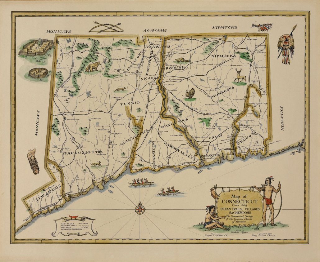
The NSCDA-CT is pleased to reissue this beautiful map in accurate color as a print from our original map in Wethersfield. Printed on presentation paper, the print is 16 by 20 inches, making it easy to frame in a commercial frame.
In 1930, Mary Pierson Cheney, president of the Colonial Dames, asked Mathias Speiss to compile a map based on his extensive research on the Indians in Connecticut. The map itself was drawn by Hayden L. Griswold, also from the town of Manchester, CT. Mr. Griswold incorporated decorative details from early Dutch maps of New England thus creating an interesting and colorful portrait of those settlements. 2000 maps were printed and distributed to schools, libraries and historical societies in the state. A few years later, a booklet titled “Connecticut circa 1625: its Indian Trails, Villages & Sachemdons”, describing these different tribes, was published. Today an original 1930 map is considered rare and difficult to find. This informative and lovely map is a welcome addition to any home, library, town hall, historical society or school.